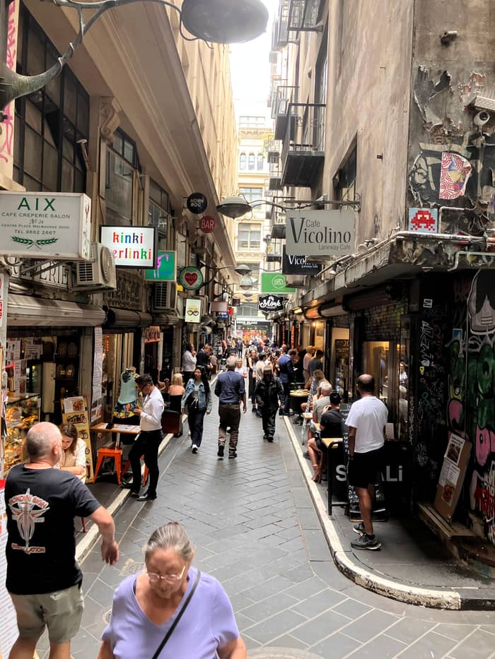
A full overview
History and laneways
Most reviewed on this platform
- Length3 hours
- MeetsGordon Reserve
- AccessWheelchair accessible
Guides
Language
Currency
Find open dates$90 and up · free cancelSpot your stop
Melbourne laneways on foot, 3 hours with a local guide
★ 4.9 · 345 written reviews
Summary
A historical walking tour in Melbourne follows the 1837 Hoddle Grid, the gold rush boom that made Melbourne one of the world's richest cities by 1888, and the crash of the 1890s.
History essentials
Open 54 stops
Tap a route first, then a pin or stop, for its note and Google Maps.
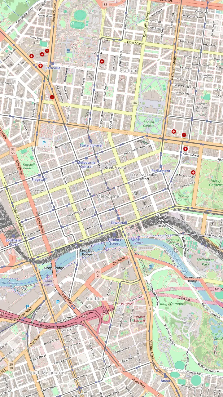
Opposite Flinders Street Station: brunch tables down the middle of the lane, street art, and small shops such as a Florentine stationer.
Google MapsA narrow, crowded alley of cafes and bars; note the Spanish Moorish Majorca Building on the corner, from 1928.
Google MapsThe lane behind the Block Arcade; its line is the reason the arcade bends.
Google MapsNamed after the fabric factories of the 1860s, now small designer and shoe shops.
Google MapsThe old rag-trade lane, with the Nicholas Building at its Swanston Street end.
Google MapsThe city's best-known street art lane, repainted so often that pieces vanish overnight.
Google MapsAustralia's first street named after a rock band, with a lightning bolt instead of the slash.
Google MapsHome of the bar that started the laneway revival, with Mike Makatron's Jungle Funk mural at the entry.
Google MapsA long lane of outdoor tables and live music; Kirk's recalls its 1840s horse trading.
Google MapsA rare survivor of the industrial city, now green with plants and cafes.
Google Maps
Australia's oldest train station site; the present building was completed in 1910. Meet under the clocks.
Google MapsA hotel built in 1861, before the station across the road.
Google MapsCompleted in 1870 in bluestone and Tasmanian freestone; free tours are offered.
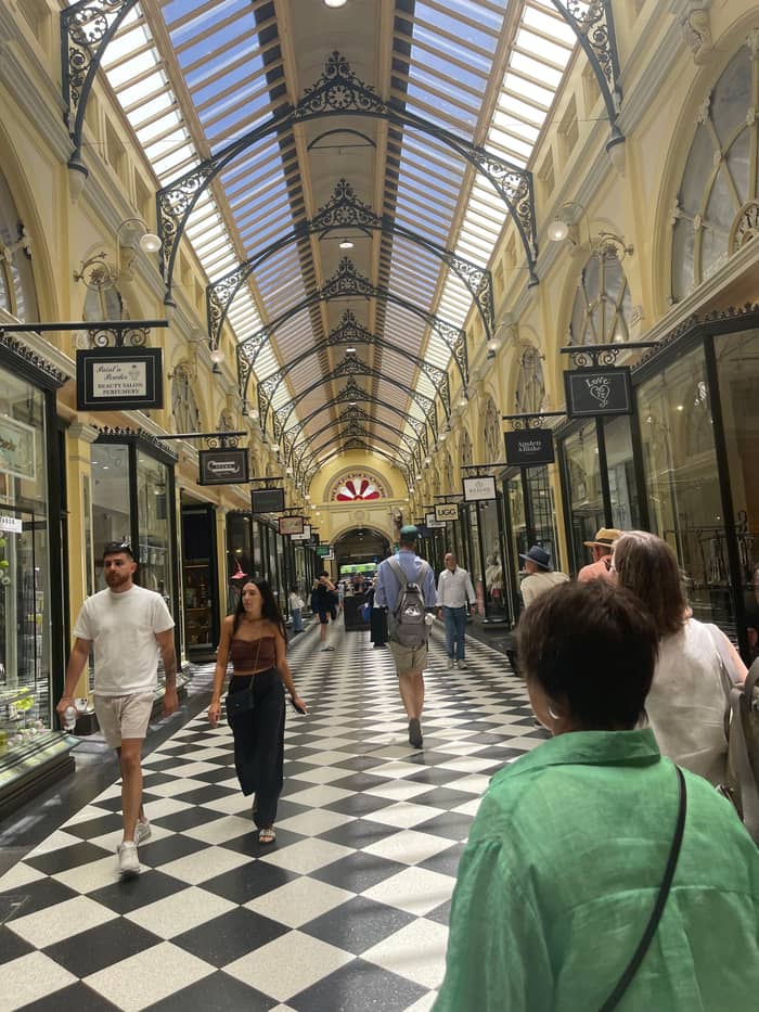
Google MapsAustralia's oldest surviving arcade, built in 1869; Gog and Magog have struck the hours since 1892.
Google MapsGlass roof and a mosaic floor laid with tiles from Europe; the Collins Street side was finished in February 1892.
Google MapsListed as the oldest building in Melbourne, in a lane off Collins Street.
Google MapsOpened in 1854; Ned Kelly's armour is on display.
Google MapsMelbourne's prison from 1845, run today by the National Trust.
Google MapsIts exhibition traces how the city boomed after the 1850s gold finds.
Google MapsArt Deco of 1932 and Melbourne's first building with escalators; mosaic arcade at street level.
Google Maps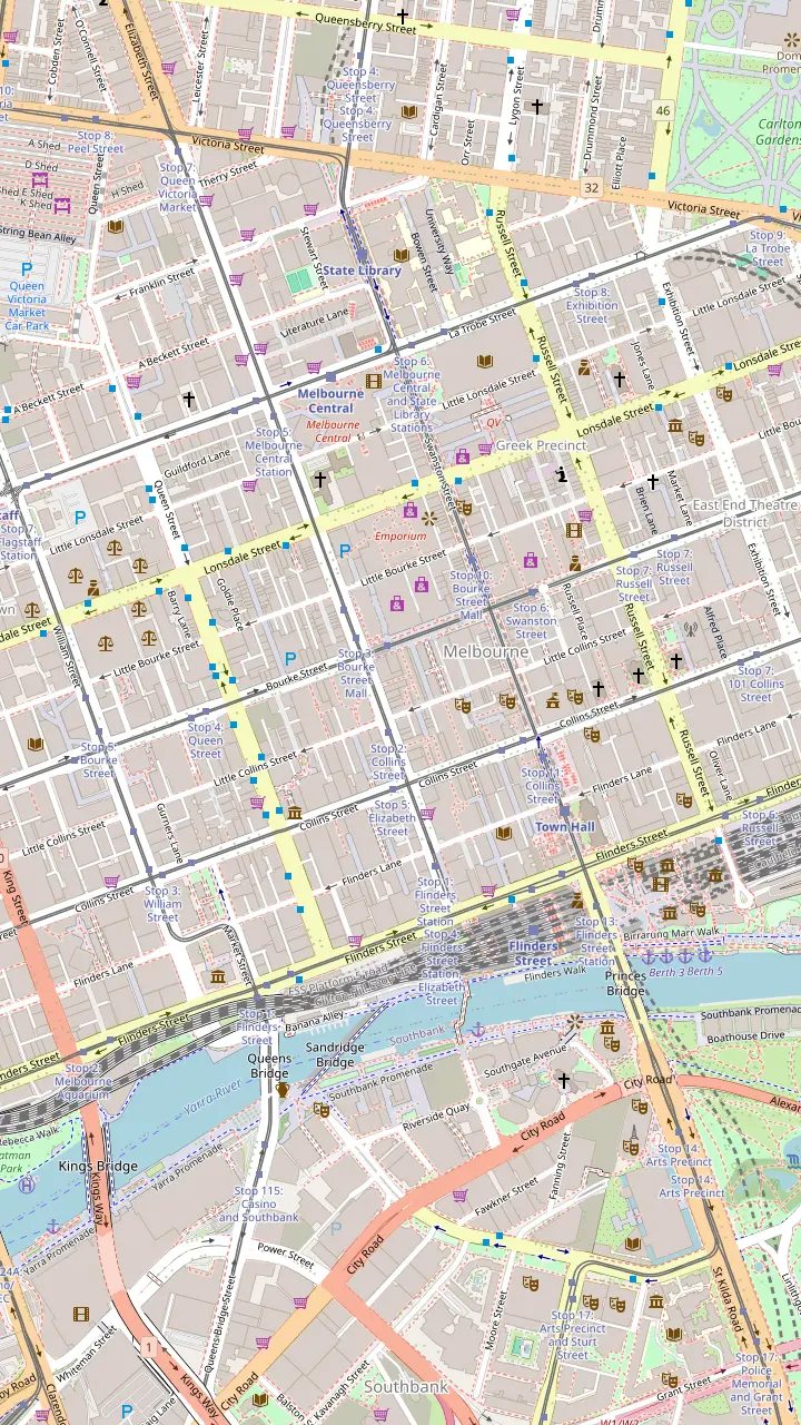
Opposite Flinders Street Station: brunch tables down the middle of the lane, street art, and small shops such as a Florentine stationer.
Google MapsA narrow, crowded alley of cafes and bars; note the Spanish Moorish Majorca Building on the corner, from 1928.
Google MapsCrepes and banh mi, and a look up at Bible House of 1898.
Google MapsAn Art Deco arcade that opens into the Nicholas Building of 1926.
Google MapsNamed after the fabric factories of the 1860s, now small designer and shoe shops.
Google MapsGlass roof and a mosaic floor laid with tiles from Europe; the Collins Street side was finished in February 1892.
Google MapsAustralia's oldest surviving arcade, built in 1869; Gog and Magog have struck the hours since 1892.
Google MapsA long lane of outdoor tables and live music; Kirk's recalls its 1840s horse trading.
Google MapsStreet art below, a piano bar upstairs.
Google MapsA double-storey shipping container bar with a rooftop.
Google MapsArtist Mirka Mora once worked here; today the balconies spill greenery.
Google MapsCoffee roasters and a shop for shoes, haircuts and suits.
Google MapsA rainbow-lit arcade with a direct way into Emporium and the GPO.
Google MapsFashion, cake and a basement bar under the lane.
Google MapsA green wall leads to a lantern-lit pizzeria; Emporium's floors of shops are at the far end.
Google Maps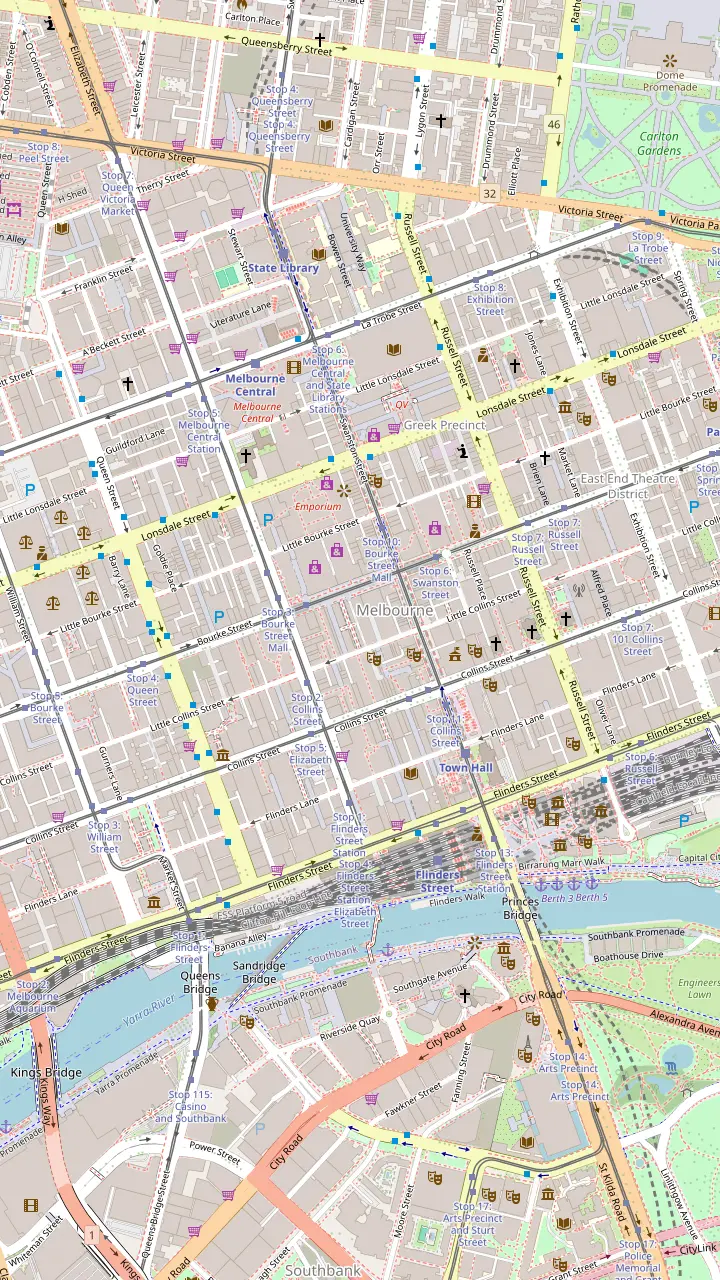
Glass roof and a mosaic floor laid with tiles from Europe; the Collins Street side was finished in February 1892.
Google MapsAustralia's oldest surviving arcade, built in 1869; Gog and Magog have struck the hours since 1892.
Google MapsEdwardian Baroque of 1911 linking Collins Street and Flinders Lane.
Google MapsAn Art Deco arcade that opens into the Nicholas Building of 1926.
Google MapsA 1924 cinema with lit ceilings by Walter Burley Griffin and Marion Mahony Griffin.
Google MapsArt Deco of 1932 and Melbourne's first building with escalators; mosaic arcade at street level.
Google MapsThe lane that leads to Presgrave Place, with a tiny vegan jaffle kiosk.
Google MapsA rainbow-lit arcade with a direct way into Emporium and the GPO.
Google MapsThe lane behind the Block Arcade; its line is the reason the arcade bends.
Google Maps
The city's best-known street art lane, repainted so often that pieces vanish overnight.
Google MapsOff Hosier Lane; even the bins here are painted over.
Google MapsAustralia's first street named after a rock band, with a lightning bolt instead of the slash.
Google MapsBig murals by Fintan Magee and Steen Jones, and one of the last Banksy rats.
Google MapsLisa King's giant sleeping woman on the wall of Brunetti.
Google MapsA miniature outdoor gallery of framed works on the walls.
Google MapsAbove the lane, a feathered portrait by Adnate and Shida from 2012; the container bar Section 8 below.
Google MapsA winding lane off Little Bourke Street with colourful murals.
Google MapsA tiled mosaic for Legacy House and a towering mural by Jaz Mishap at the end of the alley.
Google MapsNamed after Blender Studios, an early home of the city's street art scene, off Franklin Street.
Google MapsHome of the bar that started the laneway revival, with Mike Makatron's Jungle Funk mural at the entry.
Google Maps
A First Peoples arts centre founded in 1985, open daily from 10am.
Google MapsThe river camp installation: an eel path, message sticks and ancestor stones by the river.
Google MapsNamed after a Wurundjeri elder; voices play as you walk across.
Google MapsWhere people gathered from the 1890s to the 1960s to hear Aboriginal speakers.
Google MapsA traditional Kulin meeting place; a paving inlay reproduces a William Barak painting.
Google MapsA 31-storey building whose balconies form a portrait of William Barak.
Google MapsIndigenous art from the NGV collection at Federation Square.
Google MapsMeet at the Visitor Centre for the First Peoples-led plant walk, 10:45am on Tuesday, Wednesday, Thursday, Saturday and Sunday.
Google MapsBunjilaka, the place of Bunjil, inside Melbourne Museum.
Google Maps
The small park opposite the Hotel Windsor where some of the afternoon bar walks begin.
Google MapsListed as the oldest building in Melbourne, in a lane off Collins Street.
Google MapsA hotel built in 1861, before the station across the road.
Google MapsAbove the lane, a feathered portrait by Adnate and Shida from 2012; the container bar Section 8 below.
Google MapsRobot Bar, full of vintage Japanese robot figures.
Google MapsFashion, cake and a basement bar under the lane.
Google MapsArlechin takes no bookings: walk in from 5pm, Tuesday to Saturday.
Google MapsStreet art below, a piano bar upstairs.
Google MapsLive music and a late licence on AC/DC Lane.
Google MapsA 1929 theatre and one of the best places in the country for a live band.
Google Maps© OpenStreetMap contributors, map data
A historical walking tour in Melbourne reads the city from its grid: why the lanes exist, how gold and land speculation built the arcades, and what the crash left behind.
Editorial team, melbournelanewaystour.com · Updated November 8, 2026 · 7 min of reading
Quick look
Any historical walking tour in Melbourne should begin before the streets. The City of Melbourne notes that the Birrarung, the Yarra, matters deeply to both the Boonwurrung and Woiwurrung peoples, who met and held ceremonies beside it for millennia before settlers came.1 The central city stands on the lands of the Kulin Nation, and its traditional name is Narrm.6,7
That history is not hidden, but you have to know where to look. The site of Parliament House was a traditional meeting place of the East Kulin.8 Near the river, a natural waterfall that had been an important Indigenous meeting place was blown up in 1883.9 The Old Treasury Building points out that the 1839 census recorded the First Nations men then living around the township, part of a record of dispossession that ran alongside the city's growth.10
When the first town lots were sold, they were sold on Wurundjeri country for next to nothing, by the City's own account in its exhibition on the land sales.11 Keep that in mind as you walk the grid: the lanes and arcades are a story of fortunes made very quickly on land that had been someone else's. Our page on Aboriginal Melbourne covers the places where that older story can still be seen.
Era by era
| Building | Date | Era | Where |
|---|---|---|---|
| Young & Jackson | 186122 | Gold rush | Flinders St and Swanston St |
| Royal Arcade | 186923 | Gold rush | Bourke Street |
| Melbourne Town Hall | 187024 | Gold rush | Swanston Street |
| ANZ Gothic Bank | 1883-8725 | Boom | Collins Street |
| Old Stock Exchange | 1889-9126 | Boom | Collins Street |
| Block Arcade | 189227 | Boom | Collins Street |
| Commercial Bank chamber | 1891-9314 | Crash | Collins Street |
| Flinders Street Station | 191028 | New nation | Flinders Street |
Years as given by Heritage Victoria and the City's walking guides.29
The streets you walk today were set out in 1837, when surveyor Robert Hoddle laid a grid of streets and lanes on the north bank of the Birrarung.2 On 1 June 1837 he climbed onto a log and opened the auction of the first town lots.12 The State Library notes the grid was far larger than the settlement needed, which then had a population of around 4000 people.15
Hoddle wanted wide streets. In his own words he staked the main streets 99 feet wide, was told by the Governor to cut them to 66, argued that wide streets were healthier and more convenient, won, and in return gave up his objection to narrow lanes 33 feet wide.16 Those narrow lanes are the ancestors of today's laneways. Even the land was ignored: the grid paid no attention to the terrain or to houses already standing.17
The flaws showed quickly. Elizabeth Street followed the line of a natural waterway and flooded regularly.18 As late as 1841, some 1,000 tree stumps still studded Bourke Street.19 And the lanes, drawn to give rear access to 2 or 3 houses, ended up serving 10 or more as land was subdivided.20 The State Library describes them sinking into dim lanes used as urinals and tips, and favoured by criminals.21
Hoddle's widths
Widths in Robert Hoddle's own account, quoted by State Library Victoria.16
Gold changed everything. The Old Treasury Building, where the colony's gold was once kept, describes an explosion of growth after the gold discoveries of the 1850s.3 The City's architecture walk says that after the gold rush Melbourne exploded with displays of new wealth.29 By the 1880s a land and property boom that had been building since the gold rush had the whole city in its grip.30
Was Melbourne the richest city in the world? The State Library's answer is close to yes: when the colonist William Westgarth came back in 1888, he found a city that ranked among the wealthiest anywhere.4 Construction rose by more than 50 per cent as speculators pushed up land prices, and in 1884 the Octopus Act authorised 66 new railway lines.31,32 The British journalist George Augustus Sala visited in 1885 and called it Marvellous Melbourne, and the name stuck.13
The city put itself on show. It hosted international exhibitions in 1880-81 and 1888.33 Visitors were amazed by its technology, and Westgarth thought electric light, telephones and lifts were in more general use than in London.34 The banks built in a Venetian Gothic style meant to borrow the commercial prestige of Venice, and on Collins Street the fashionable spent their afternoons doing the Block.35,36
Pick your history walk
Choose the line closest to your interest.
If I want the big picture
History and laneways
3 hours across the city's history and lanes.
If I like a scare
Ghost walk
1.5 hours of murder and mystery after dark.
If I want crime history
Crime walk
1.5 hours, wheelchair accessible.
If I want to go at my own pace
The gaol and the library
Old Melbourne Gaol and the State Library are a short walk apart.
If I want laneways with the history
The laneways tour
Stories of the lanes in 3 hours.
Three history walks
A full overview
Most reviewed on this platform
Runs in all weather
After dark
Small group
Sweet stops
There was another city behind the facades. The Old Treasury Building describes the little streets and alleys between the grand boulevards, with cramped, crumbling housing for the poor.110 The drains stank, the water was polluted and typhoid was common, so critics renamed the place Marvellous Smellbourne.111 The lanes you now visit for coffee were part of that world.
Then the money ran out. The State Library records that less than a decade after the boom peaked, the speculative land bubble popped and a long economic gloom set in.5 Building societies that had lent freely collapsed, among them the short-lived City of Melbourne Building Society, whose 1888 headquarters still stands on Elizabeth Street.112
Some of the finest interiors date from the crash itself. The Commercial Bank of Australia's domed banking chamber on Collins Street was designed and built in 1891-93, in Heritage Victoria's words a time of great financial crisis for Victoria.14 When Melbourne recovered, about 10 years later, it was ready to become the first capital of the new nation.113
Price a history walk
Choose your group size to compare starting totals.
Compare 4 alternatives
Choose your group size to compare starting totals.
≈
View≈
View≈
View≈
ViewFrom-prices on GetYourGuide, shown at the ECB reference rate. Your exact price is confirmed during booking.
The city in dates
1837
Hoddle lays out streets and lanes.2
1 June 1837
Hoddle auctions lots standing on a log.12
1850s
Growth explodes after the gold finds.3
1885
Sala coins the name.13
1888
Among the wealthiest cities anywhere.4
1891-93
Banks build through a financial crisis.14
A history walk through the lanes is mostly a walk past survivors. The Mitre Tavern, off Collins Street, is listed as the oldest building in Melbourne.89 Young & Jackson on the corner opposite Flinders Street Station was built in 1861, before the station.22 Melbourne Town Hall, finished in 1870, is built of bluestone with Tasmanian freestone.24
The arcades carry the boom in their bones. The Royal Arcade was built in 1869 and is Australia's oldest surviving arcade, and the Block Arcade's Collins Street section followed in February 1892.23,27 Nearby, the Old Melbourne Stock Exchange of 1889-91 has stained glass and gargoyles, and William Wardell's ANZ Gothic Bank of 1883-87 has gilded ceilings.26,25
The State Library on Swanston Street opened in 1854 as the Melbourne Public Library and holds Ned Kelly's armour.90,91 Flinders Street Station was completed in 1910, and since then Melburnians have met under its clocks.28,114 Walk them in a loop and you have the whole arc of the city, from frontier pub to boom-time bank to railway age.
Video
Industrial South on YouTube · The video stays unloaded until you press play.
By the time William Westgarth returned in 1888, Melbourne was one of the richest cities in the world.
Melbourne's darker history has its own walks. The Old Melbourne Gaol has been the city's most feared prison since 1845 and is now run by the National Trust; inside you can see the gallows where over 100 people were executed and Ned Kelly's death mask.92,115 The free City Circle tram stops nearby, at stop 7 on the corner of La Trobe and Russell streets.108
Evening ghost walks lean on the city's theatres and pubs. Facing Parliament, the Princess Theatre is said to be haunted by Federici, the opera-singing ghost.116 The most-reviewed ghost walk meets outside Young & Jackson, lasts 1.5 hours and runs in all weather, from $27. A crime walk of the same length meets by the Eight-Hour Day Memorial and is wheelchair accessible, from $24.
Take these walks for the stories, and treat the stories as stories: ghost tours mix documented history with legend, and part of the fun is telling them apart. The gaol, the court records and the State Library's collections are where the documented part lives, and they are open to anyone curious enough to follow up.
For generations after the boom the lanes stayed what Hoddle's plan had made them: service alleys for deliveries and bins. The change came from the bottom up. The City credits a bar in Meyers Place with launching Melbourne's laneway revolution, and others followed into empty back-of-house spaces.48
Since then the City has backed the lanes with programs of its own. Its Green Your Laneway program has turned lanes such as Meyers Place and Katherine Place into planted spaces.117,118 The Flash Forward program brought new art to 40 city laneways, and the city's first official street art precinct followed in December 2017.119,120
That is the twist at the end of a Melbourne history walking tour. The narrow lanes Hoddle reluctantly accepted, the ones the State Library describes as rubbish tips in their early years, are now what visitors cross the world to see.21 The guided laneways tour this site sells tells that story on the ground, on a walk of 3 hours capped at 10 people.
FAQ
The State Library says that by 1888 the city ranked among the wealthiest in the world.4
The surveyor laid out the grid of streets and lanes in 1837.2
George Augustus Sala gave the city that name when he visited in 1885.13
It is listed as the oldest building in Melbourne.89
The most-reviewed ghost walk lasts 1.5 hours and meets at Young & Jackson.
The library on Swanston Street holds his complete armour.91
Sources
Next read
Not sure which walk to book? Ask a real person here.